
The Bronze Line
Montréal is a city on the go. There are always two million things happening. Some things are small, like a fresh batch of sesame-seed bagels coming out of a wood-fired oven. Some are massive, like the international fireworks competition which illuminates the city on Wednesdays and Saturdays through the month of July. Some are shared, like the fireworks. Some are jealously guarded, like the bagels.
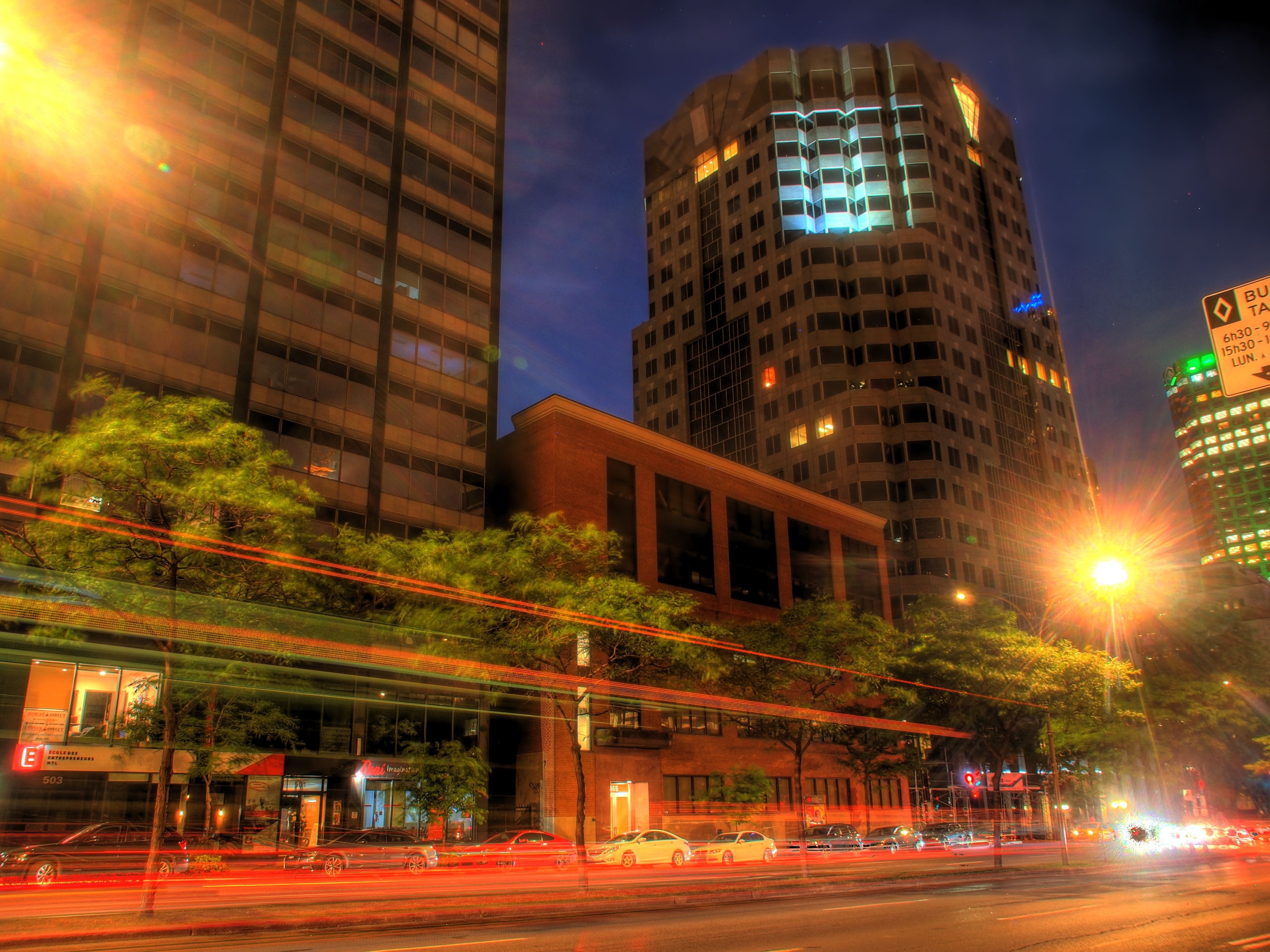
Much of the time, the location of whatever-it-is that a person wants to experience is across town somewhere. The island would suffocate if everyone took individual cars to get around. That is why the Métro really shines. It gets les Montréalais where they need to go. As the city grows and changes, so too does the public transportation scheme. In this month's log I share my own personal flight - or Métro ride - of fancy as it relates to moving around town. First, though, here are a pair of shots from the aforementioned fireworks competition.
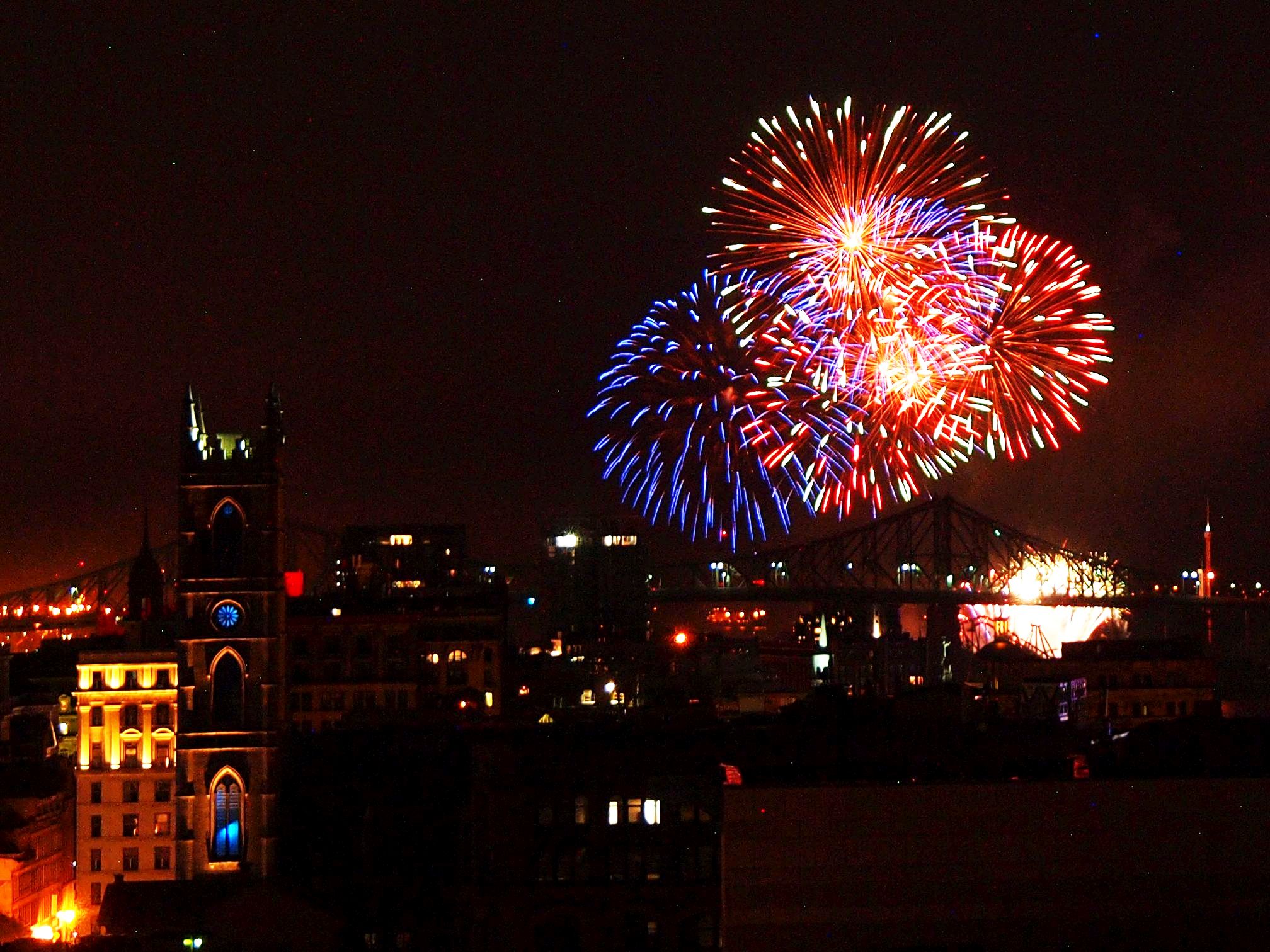
Olympus E-PL1: f5.6, 1 sec, ISO 320
IrfanView: Crop, Colour Balance
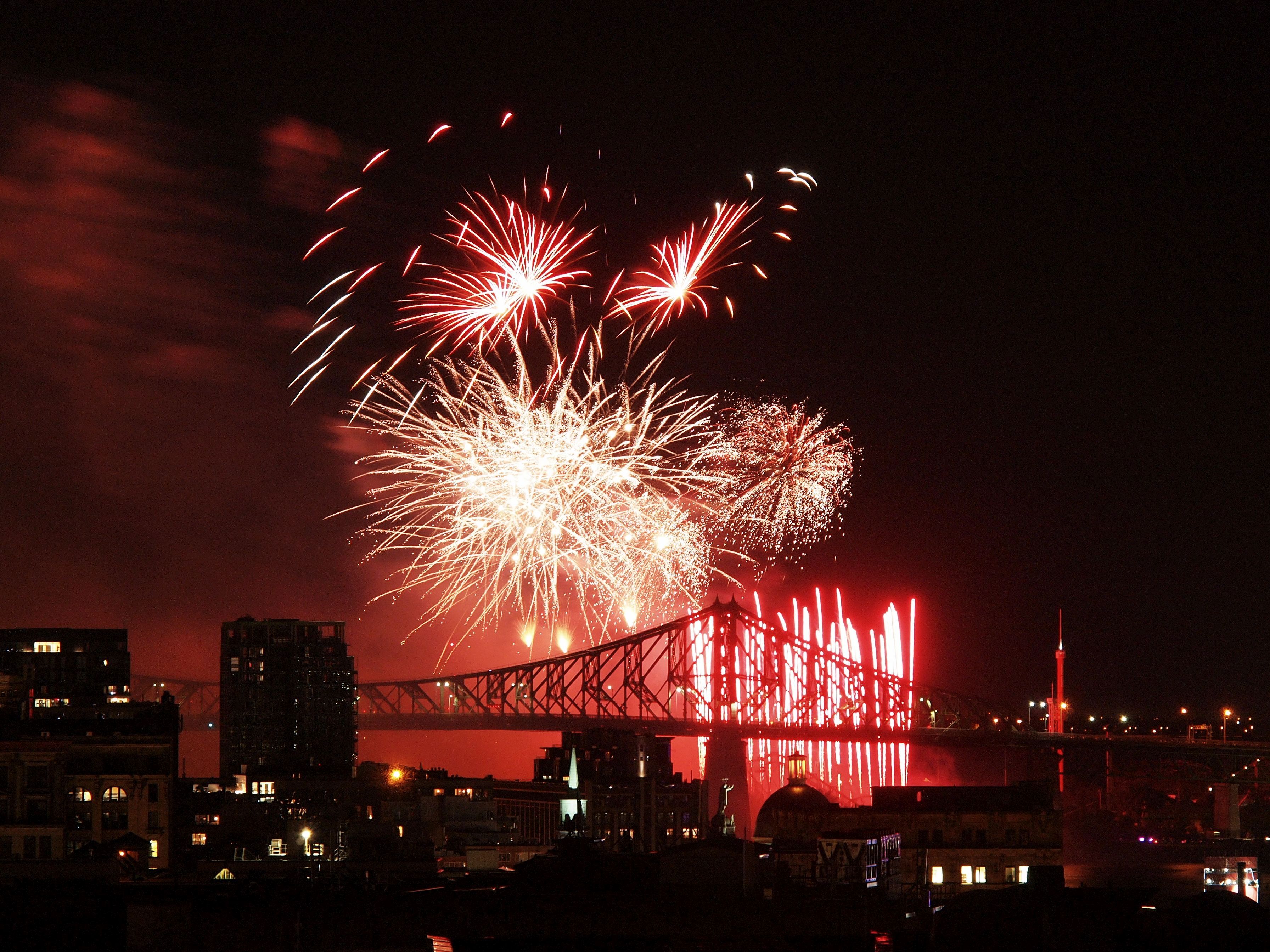
Olympus E-PL1: f8, 8 secs, ISO 200
IrfanView: Crop, Colour Balance
There are some major transportation projects happening in Montréal this summer - the three largest in North America, to be exact. Two are (mostly) road-related, a highway upgrade and the new Champain Bridge. The Bridge will have a place set aside for part of the third project, the REM. Short for Réseau Express Métropolitain, the REM is a commuter rail system which will include 26 stations over 67km.
Also recently announced were two more big projects, related directly to the Métro. The main one for today is the extension of the Blue Line; the second one is a new tram line. On the drawing board for about as long as I have been alive, the Blue Line extension seems finally poised to add five stops - and about 25,000 users to the Métro every day. I am very excited about it (even if it will come long after I have left the city). My only concern is where all those people will go after they're aboard...
Here is an edited Métro system map. Note the Blue Line going past its current North terminus, Saint-Michel, all the way to Anjou. I gave the new stations names (Official ones aren't picked yet).
Alas, the Orange Line is already over capacity between Jean-Talon and Berri-UQAM stations, where Blue Line folks transfer to Orange to get downtown. How will 25,000 more riders fit?
My multi-billion dollar imaginary solution is to add a whole new route, the Bronze Line. It would be a bit under 7km long, and have eight stops. The colour bronze combines blue and orange, and it is also the same word in French and English. Plus, it has an Olympic ring to it, which is always nice.
Eagle-eyed observers may note that I also inserted a stop to the Yellow Line, Vieux-Porte. I think a station there would be handy, and may help to alleviate the overcrowding at Berri-UQAM.
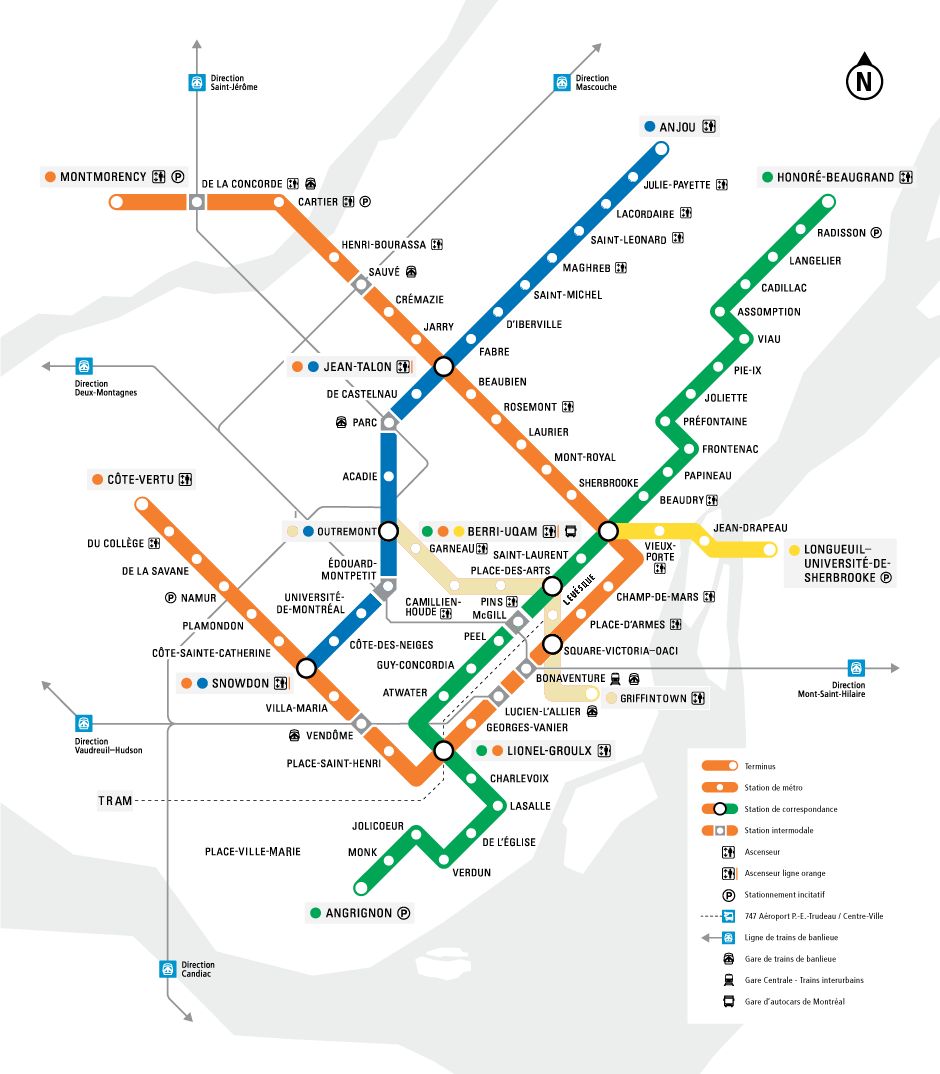
From STM, edited. Note the new Bronze Line
The map below shows the routing of the Bronze Line. It begins at Outremont Station, on the Blue Line, then goes through Mont-Royal Park and the city core to Griffintown. Hopefully some commuters would choose this route over the Orange Line, thus making the whole system more efficient and comfortable.
I know these maps may appear too small to read. As with all my images, you can open these in a new tab or window to view them at full size. To do that, simply right-click or mouse-wheel-click on them.
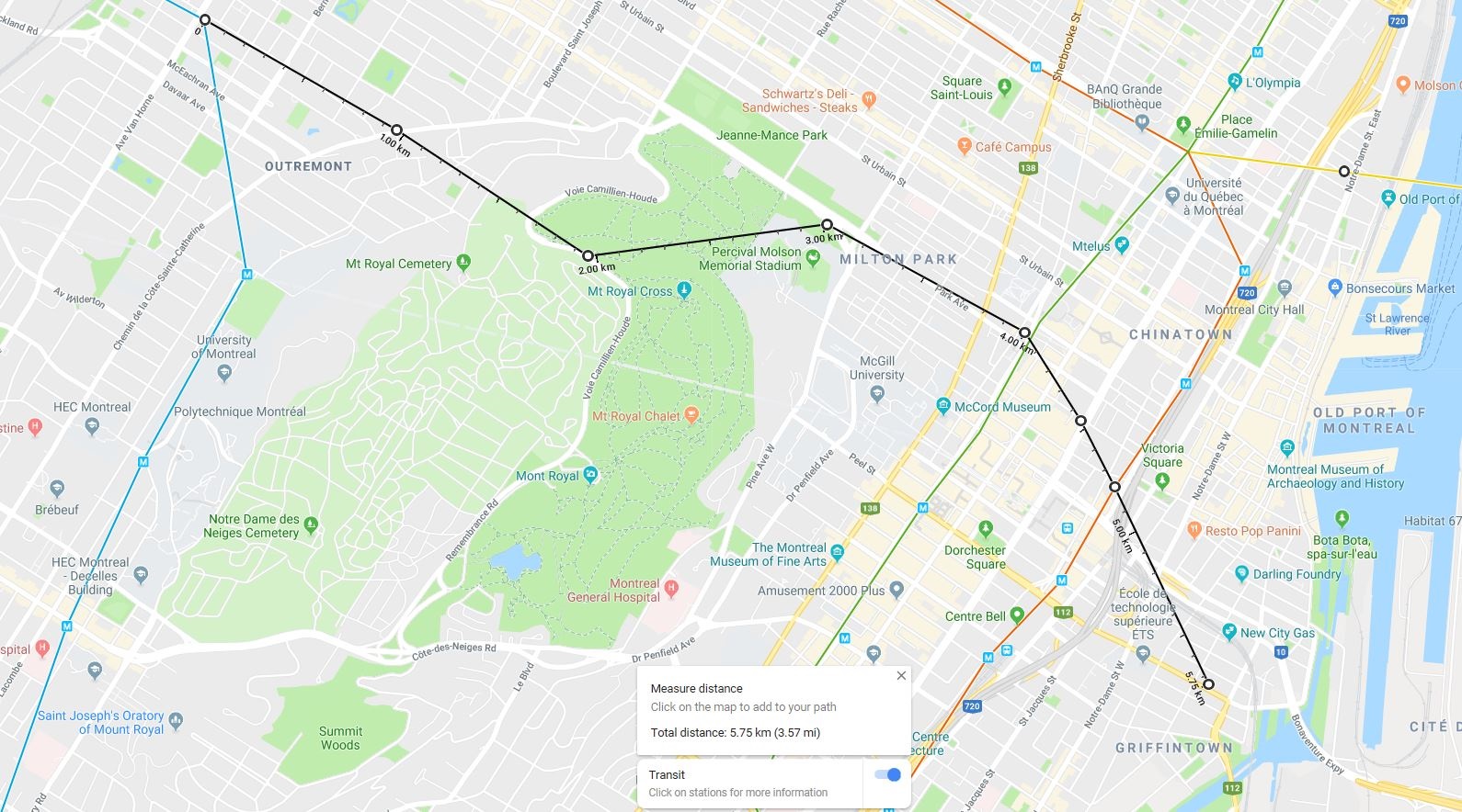
From Google Maps, edited
Here is the list of stops for the Bronze Line:
- Outremont (Blue Line transfer)
- Garneau
- Camillien-Houde
- Pins
- Place-Des-Arts (Green Line transfer)
- René-Lévesque
- Square Victoria-OACI (Orange Line transfer)
- Griffintown-ÉTS
Olympus E-PL1: f4.1, 1/60 sec, ISO 1000
IrfanView: Crop, Colour Balance
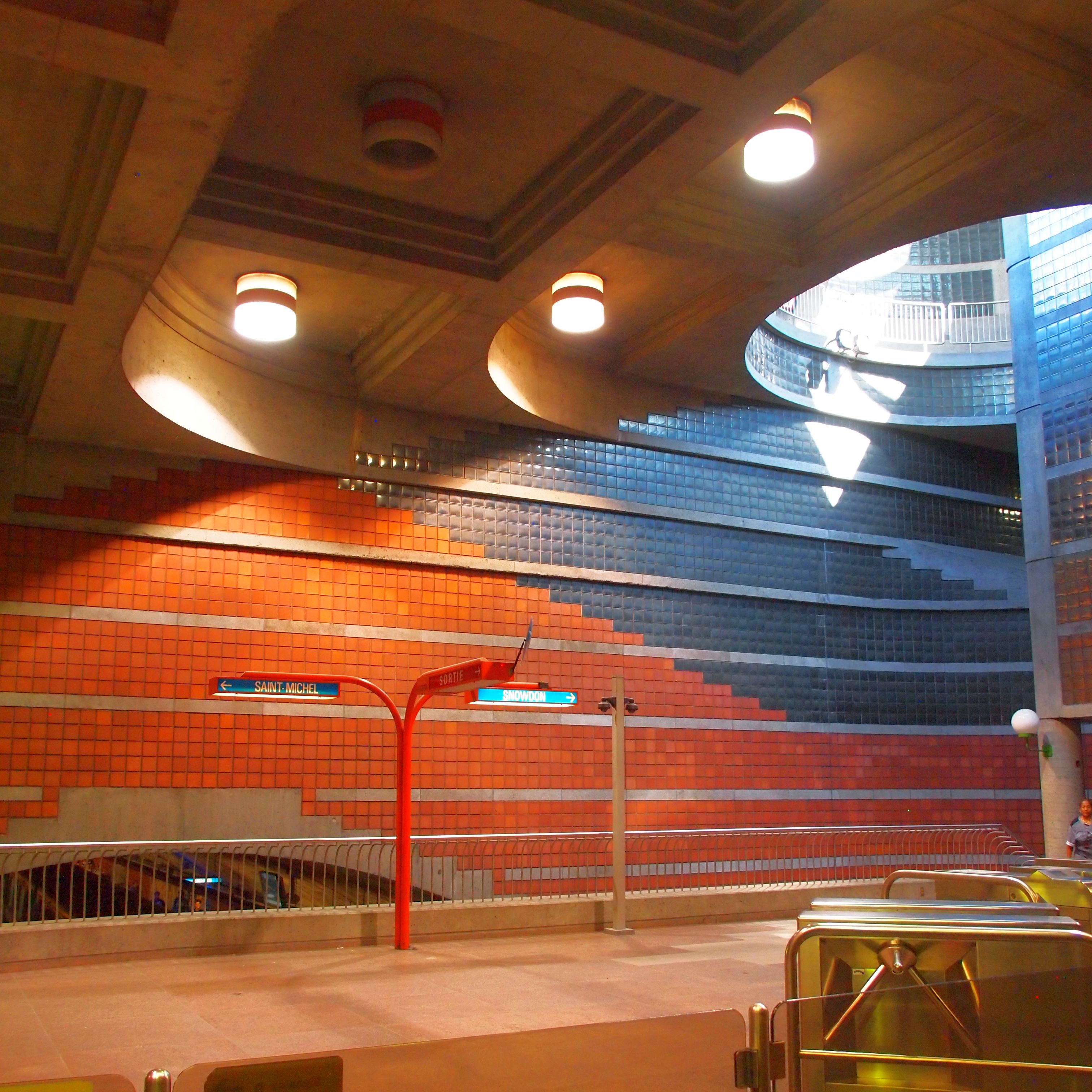
Outremont Station
Outremont Station is located in the Outremont neighbourhood (go figure!). I chose it as the first terminus of the Bronze Line primarily for its location. It is a fairly quiet station, ranking 59th out of 68 in passenger entrances in 2007.
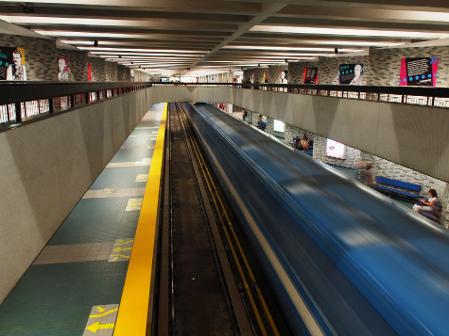
Most Métro stations are single side-platform stations. The tracks run through the centre, with a platform on either side. My Bronze Line stations would instead have a double centre platform, with the tracks along the outside and a common waiting area in the middle. That would make them easier to serve with elevators and stairs, particularly at transfer stations like Outremont. Like the REM, the Bronze Line would have safety screens between the platform and the rails.
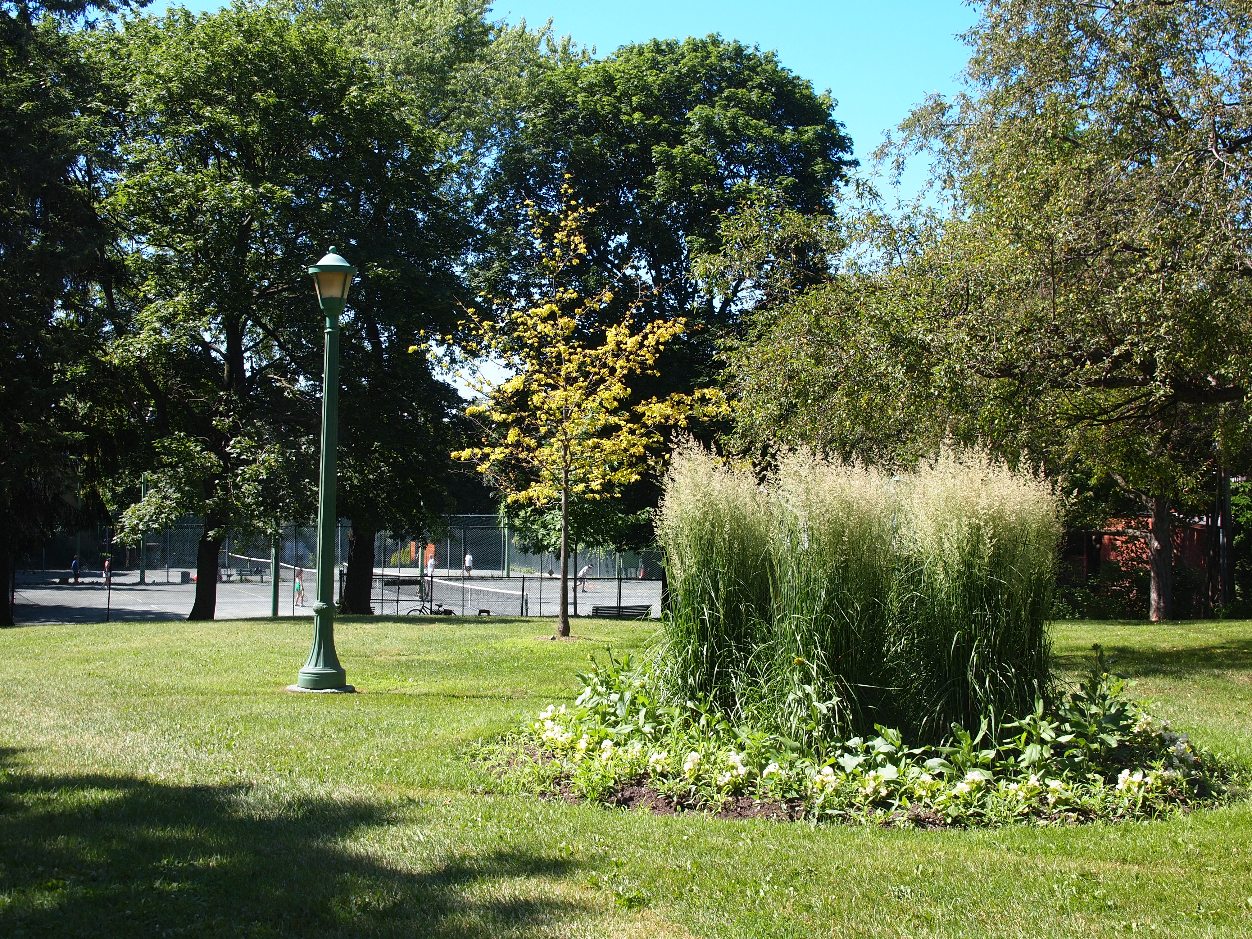
Garneau Station
Parc FX-Garneau is named for an important French Canadian historian. It is small and sleepy, notable for being home to a tennis court. It is on a major street which brings people (and busses) around the much larger Mont-Royal Park. That makes it a good place to attract riders.
I would build the station with plenty of windows shining on the platform below. I would include an easily-accessible tennis court on the roof of the building, keeping the park's current users happy.
Olympus E-PL1: f8, 1/200 sec, ISO 200
Olympus E-PL1: f22, ISO 125
PhotoMatix: HDR Toning
IrfanView: Crop, Colour Balance
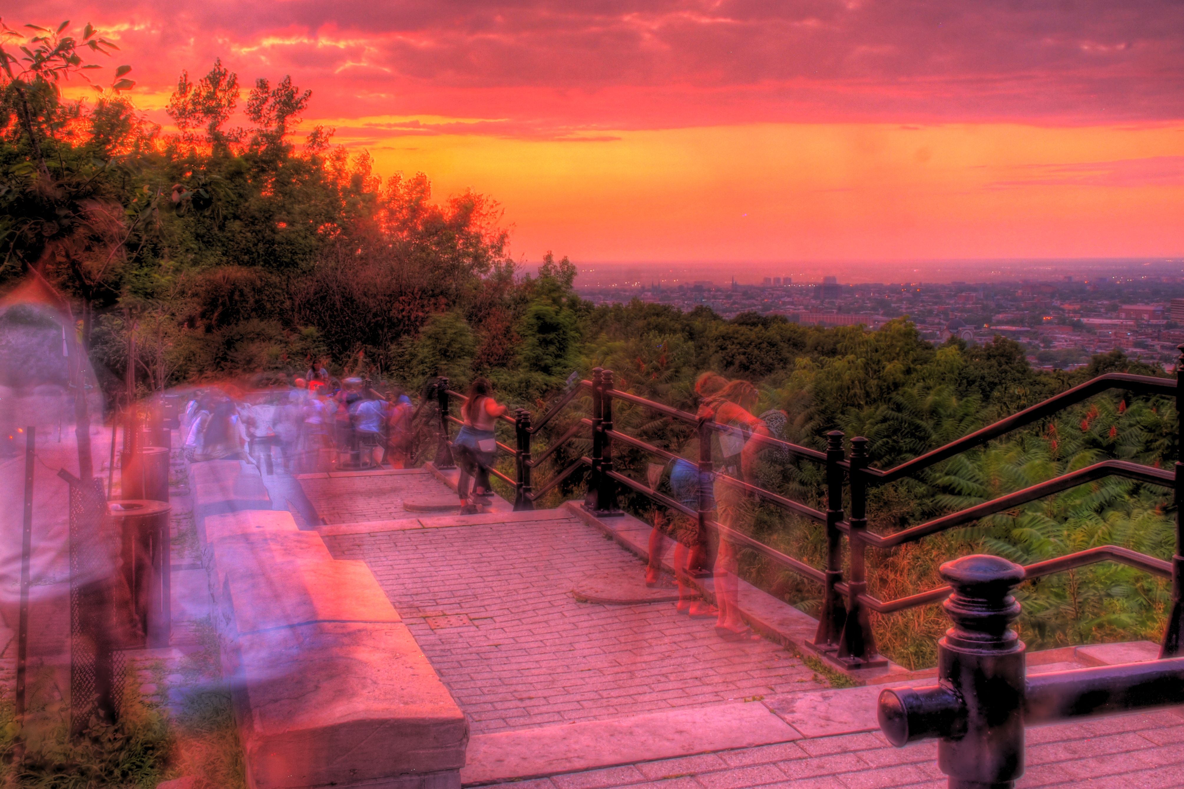
Camillien-Houde Station
When my parents came to visit me, I wanted to take them up Mount Royal. Unfortunately, we did not get all the way to the top, as it is a hefty hike. Having a Métro stop at the Camillien-Houde Belvédère would make the park more accessible to all. It is also a key part of my plan for the Bronze Line to serve both workday commuters and also weekend users seeking more leisurely activities. In case you are wondering, Camillien Houde was a city mayor who played a large role in the creation of Mount Royal Park.
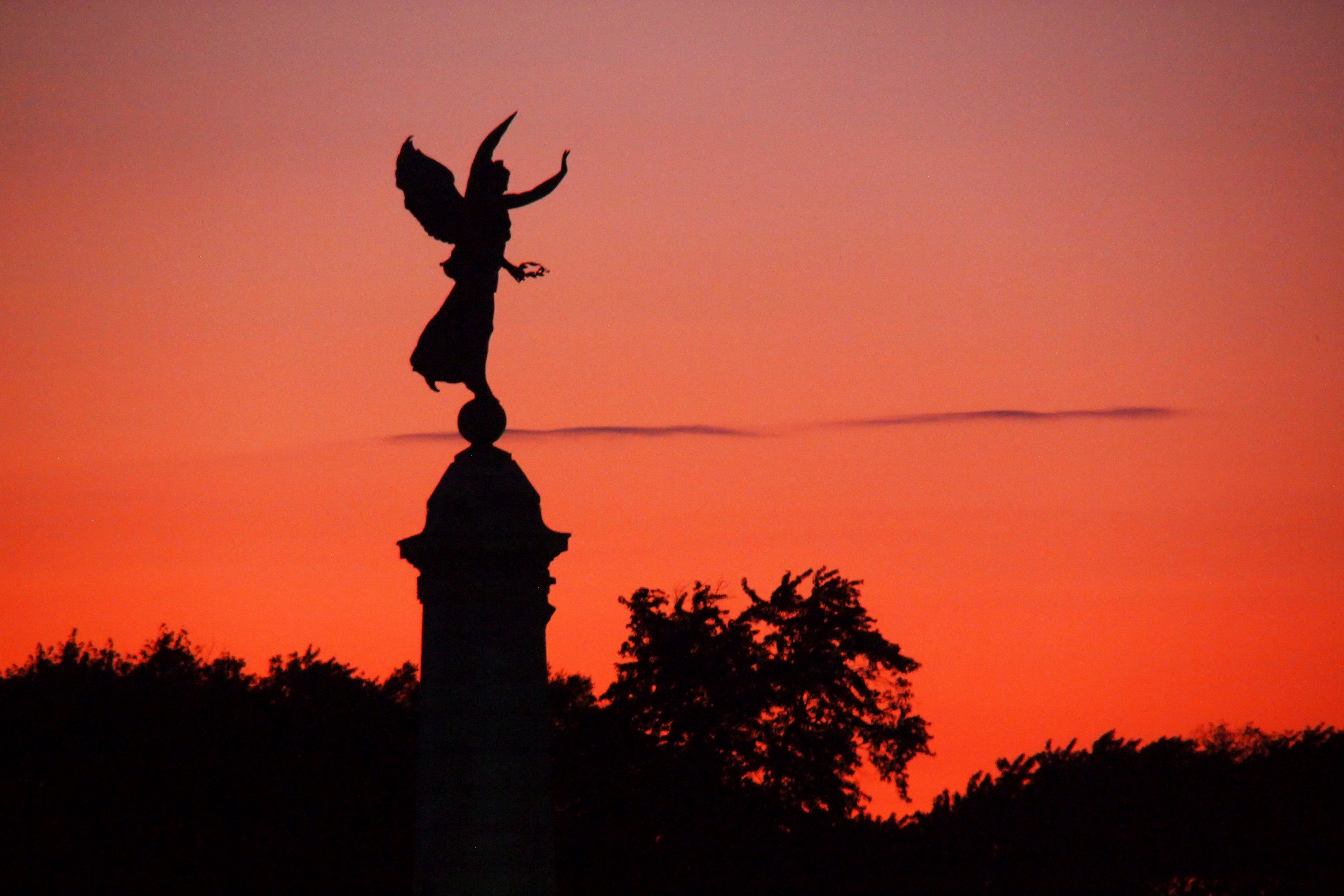
Located between the Bronze Line's Camillien-Houde and Pins stations is the downhill portion of Mont Royal Park. It features the Étienne Cartier Monument, which is topped with an angel of victory. One of the perks of my (repeated) traipsing the path of the Bronze Line was seeing the statue at dusk.
Olympus E-PL1: f5.6, 1/60 sec, ISO 1600 // IrfanView: Crop, Colour Balance
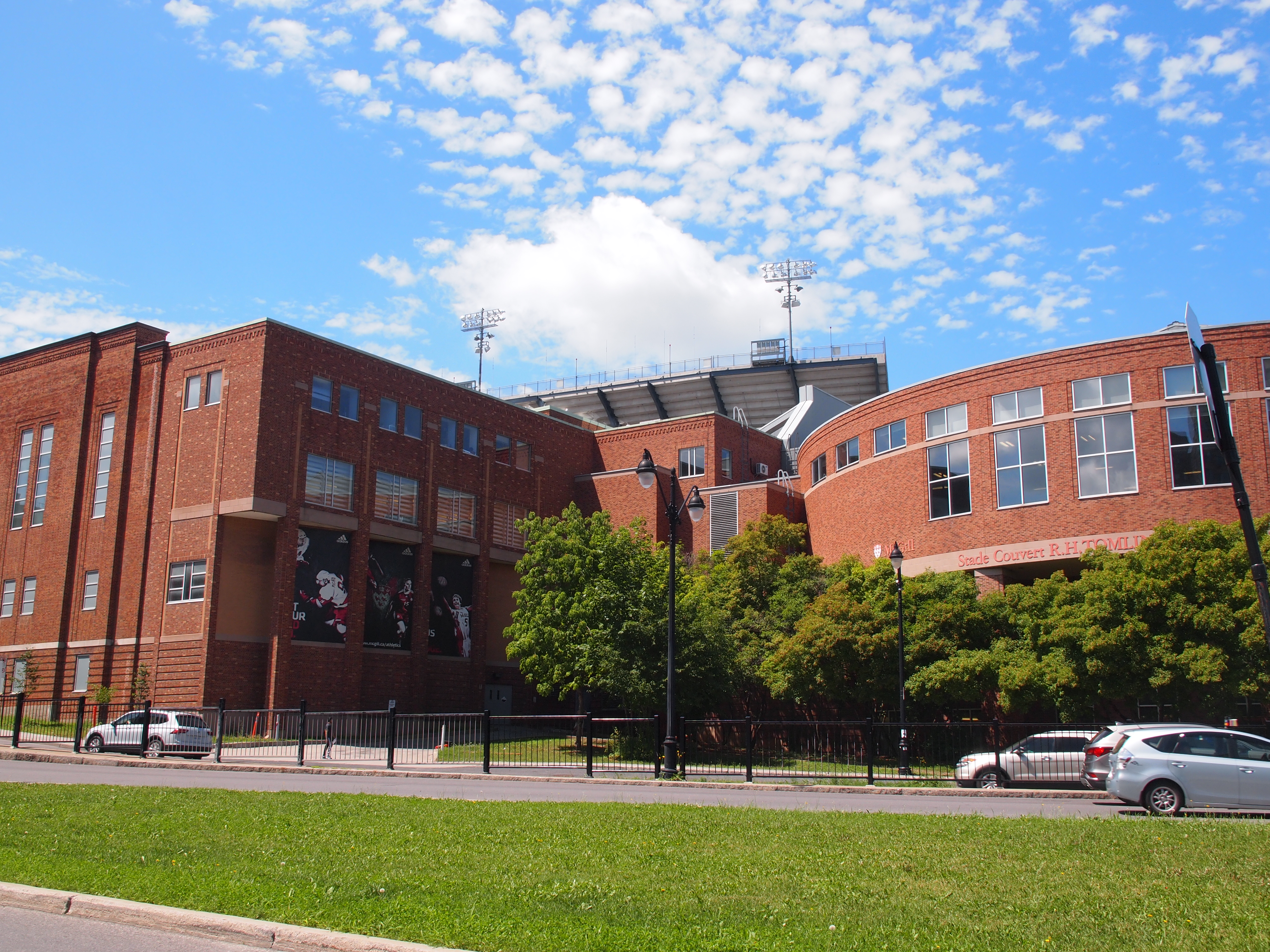
Pins Station
To an Anglophone, Pins seems like an odd name. It's the French version of Pines, and this station is located near the intersection of Parc and Pins streets. It is the first downtown station on the Bronze Line. Importantly, it is located near McGill University, and specifically right beside the Percival Molson Stadium, where the university football team plays. So, too, do the Montréal Alouettes. Once again my goal is to provide a mullet station for both business and party uses.
Olympus E-PL1: f9, 1/320 sec, ISO 200
Olympus E-PL1: f8, 1 sec, ISO 200
IrfanView: Crop, Colour Balance
Place-Des-Arts
Place-Des-Arts Station already exists. It is on the Green Line, amidst office towers and performance venues. It is near several churches - not surprising in the city of a hundred steeples! Among them is the one I attend, Saint James United.
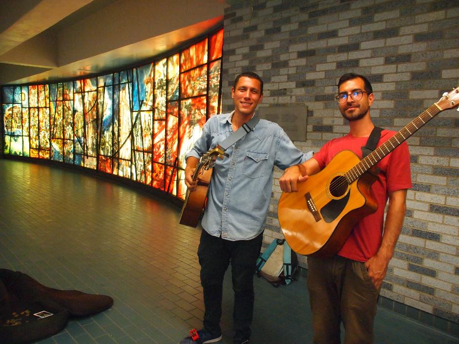
Each station of the Métro has unique architecture and art. Place-Des-Arts features balconies and and bridges above the platforms. Info plaques tell the histories of people for whom stations are named. Below are two of the Métro's excellent buskers, appropriately in front of a stained glass that portrays the history of Québécoise music.
Olympus E-PL1: f4, 1/60 sec, ISO 1600
We are halfway through our trip on the Bronze Line! Let's take a quick break here and discuss the other big announcement that I mentioned at the beginning. The province and city have agreed to build a tram line from downtown to Lachine. It is shown on my Métro map.
The tram is actually just a part of a larger idea, the Pink Line. That was Mayor Plante's primary campaign promise; a long transit corridor from the far Northeast to the Southwest. The tram will fulfill the promise for the Southwest zone.
There are four downtown streets on which the new tram could run. René-Lévesque and Sherbrooke are both too busy for it. That leaves two parallel one-way streets: Maisonneuve (which has a bike lane) and Sainte-Catherine.
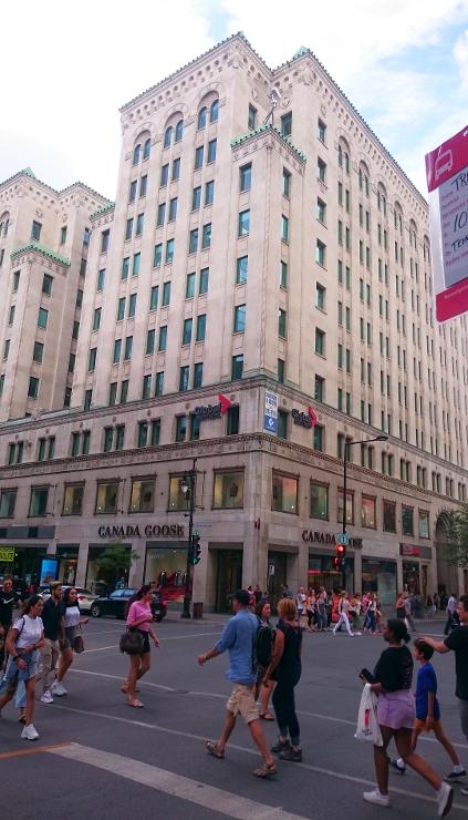
I suspect the tram will go on Sainte-Catherine. It is always packed with pedestrians, as this picture shows. If it were car-free, it could fit the tram and the bike lane, all while having more space for walkers. Moving the bike lane would free Maisonneuve to host two-way car traffic.
Sony Xperia Z3c: f2, 1/400 sec, ISO 50
IrfanView: Crop, Colour Balance
If a new Métro line or a tram could connect the Northern neighbourhoods to the extended Blue Line, my Bronze Line could be the central link in a transit chain following Mayor Plante's route.
Olympus E-PL1: f5.6, ISO 200
PhotoMatix: HDR Toning
IrfanView: Crop, Colour Balance
René-Lévesque Station
Boulevard René-Lévesque is a busy thoroughfare lined with office towers, but no Métro stations. The unassuming brick building shown here is located about as far from any station as one can get in the central business district. I suspect that a stop here would be much-used.
This area also happens to be a subterranean dead-zone; the Underground City flows around it like a stream passing an island. By building a station, the city would encourage better RÉSO links in this one spot where now there are none.
Square Victoria-OACI Station
I live just around the corner from Victoria Square, a cute little park. The OACI is the UN's oversight agency for commercial air traffic.
Square Victoria-OACI is an existing station on the Orange Line. It has many entrances. This one, with its adjacent flower vendor, is my favourite.
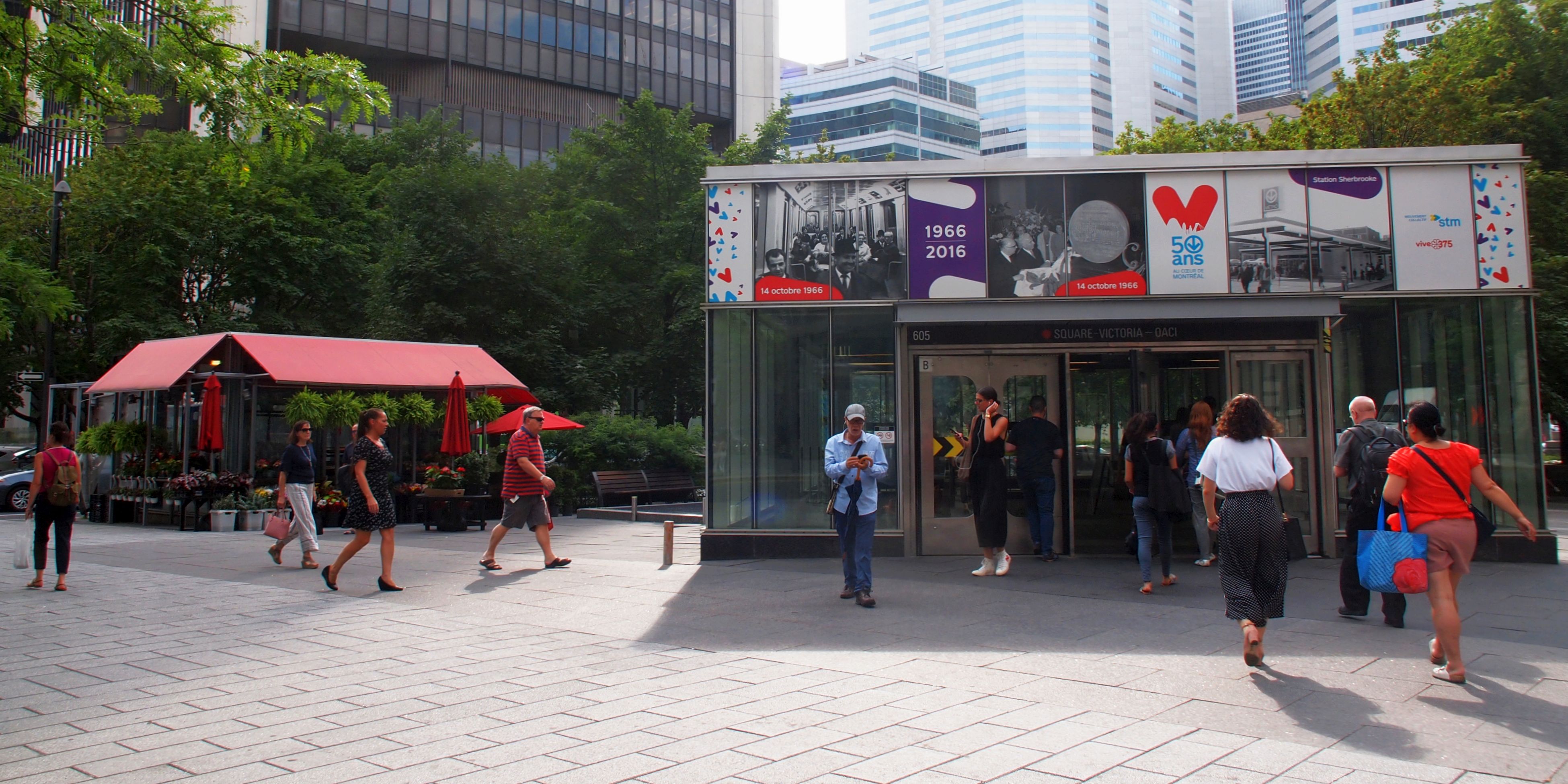
Olympus E-PL1: f7.1, 1/250 sec, ISO 200
IrfanView: Crop, Colour Balance
Griffintown-ÉTS Station
The whole Griffintown area seems to have been built up overnight. It is filled with big residential buildings and shops. At the heart of this vibrant hotspot, the entrance to my Bronze Line station would go in this mixed-use building. It also happens to host my local supermarket.
ÉTS, in case you're wondering, is a nearby trade school, the École de Technologie Superieure. It is Montéal's only major post-secondary institution not to have a Métro station named for it.
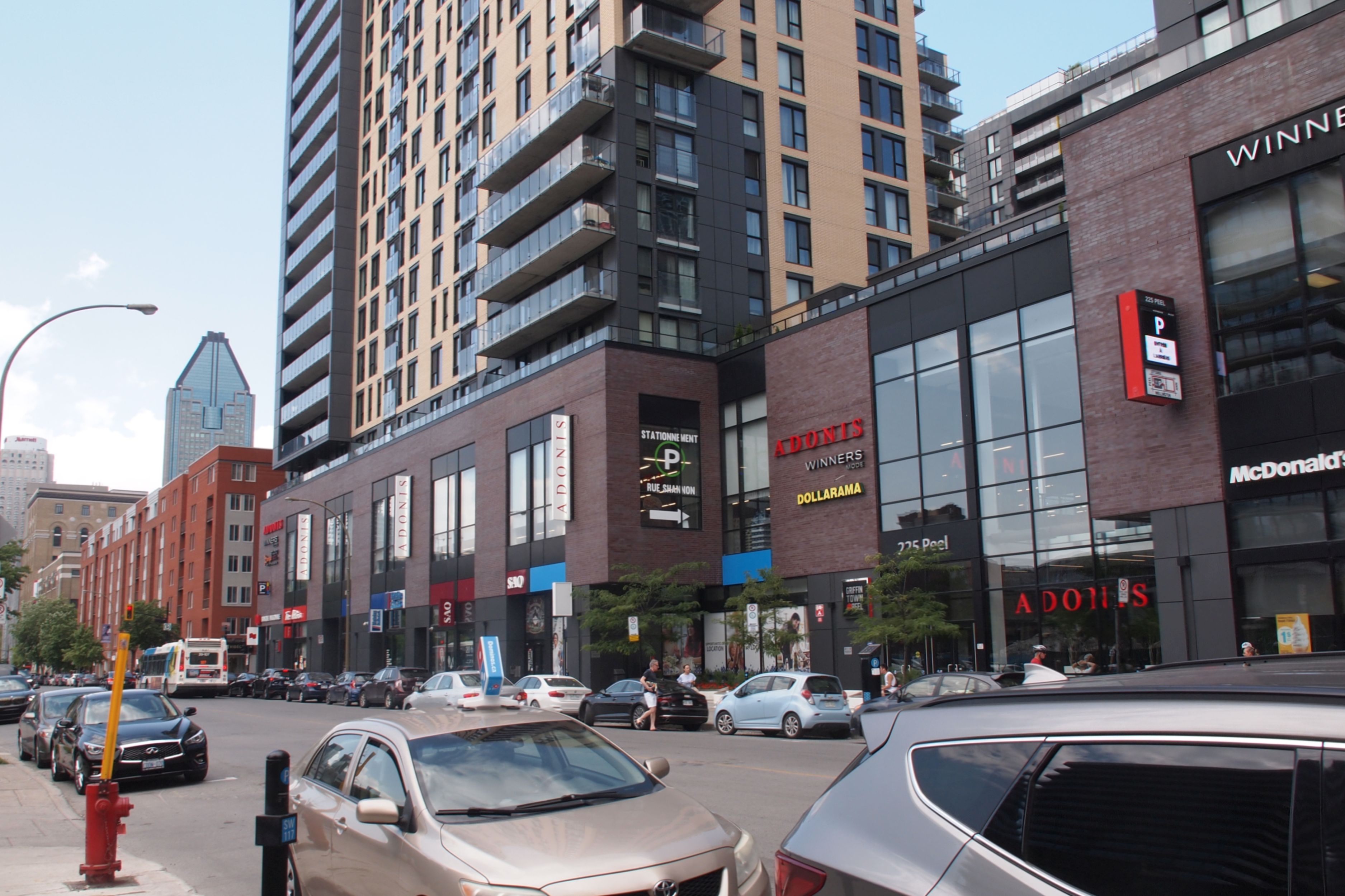
Olympus E-PL1: f7.1, 1/250 sec, ISO 200
IrfanView: Crop, Colour Balance
I love to daydream (don't we all?) but I do understand that my beautiful vision will probably never come to pass (even if it is required!). Others have noticed the need, and so the downtown leg of the REM follows a similar route. I am in Montréal working on the REM, so obviously I hope it is a success. Still, as nice as it will be, it won't be the original Métro. We do not know yet if transferring between the two mass transit systems will be seamless. If they are, great. If not, well, the Bronze Line idea is here.
On the upside, I do not have to worry that Griffintown will never see Métro trains. It already does! Across the street from my grocery store is this community-run café and art space, MR-63. The name comes from its signature pavilions - two retired Métro trains. The MR-63s were the original carriages used when the system opened. Last year the venerable vehicles were retired, and several were given to groups and institutions to find a new life above-ground. To me, they're a splendid sight.
